Aerial Data from Bukoba, Tanzania
November 30th, 2016

At the beginning of October, WeRobotics spent several days in and around the Tanzanian city of Bukoba, which was recently hit by a major earthquake. We were exploring the possible uses of aerial data for analysing earthquake damage, and training local drone pilots on long-range mapping drones. You can read about the mission through our original blog post.
Though we are still analysing the aerial and ground-based imagery to judge it’s usefulness to earthquake assessment, we’d like to release the processed orthomosaics and 3D models.
The data is currently hosted on three separate services:
- Pix4D Cloud: We use our Technology Partner Pix4D’s software to process our large aerial datasets. They’ve recently upgraded their cloud-based offerings, allowing us to host and easily share both 2D and 3D data. If you’d like to play with our models are zoom in closely on individual maps, have a look at the Pix4D links.
- OpenAerialMap: this open-source project catalogs aerial (both drone and satellite) data from around the world through an open-source model. It also provides some hosting space for those that do not have their own servers. If you are a GIS enthusiast, you can download the (rather large) GeoTIFF files directly from this site.
- Google Drive: In order to ground-truth the aerial data, we took some images of damaged buildings from the ground (geotagged through a smartphone). You can download these images here: http://drive.google.com/drive/folders/0B-H6SGl-otHaWVAyb21iaThKZ2s?usp=sharing
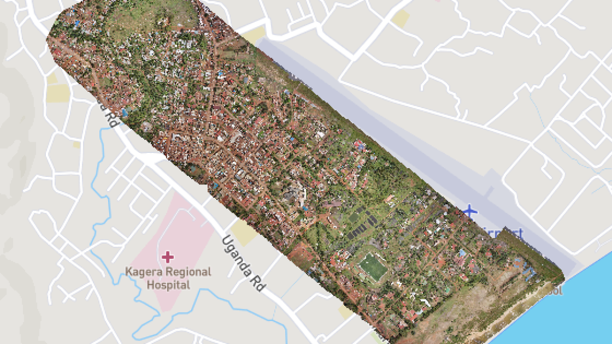
Bukoba City
This dataset covers part of the downtown core of Bukoba, and was captured using a SkyWatch Cumulus fixed-wing drone.
Click to explore on Pix4D or download on OpenAerialMap.
Bukoba North
This area north of the town of Bukoba was one of the areas worst affected by the earthquake. It includes many rural residential buildings, as well as a school that was damaged and is currently being re-built.
Click to explore on Pix4D or download on OpenAerialMap.
Bukoba Damaged School
This small area was mapped using a Parrot Bebop2 drone. It provides a more close-up view of the school that was damaged and is being rebuilt.
Click to explore on Pix4D or download on OpenAerialMap.
Marukuru
This area south of Bukoba was also damaged during the earthquake. The area is more sparsely populated, and the large palm leaves makes it more difficult to judge damage from the air.
Click to explore on Pix4D or download on OpenAerialMap.
We encourage anyone to play with this data and keep us in the loop on any analysis that you find pertinent.
Location(s):
Recent Articles

