
The “We” in WeRobotics: Celebrating Gilles and Uyangaa
July 2, 2025
We bid farewell to cherished members of our team and hear from them what the journey has been like.
November 21st, 2018

In the last 7 months, WeRobotics, Tanzania Flying Labs and Agrinfo have been gathering field data in rural Tanzania for the NASA Harvest Consortium’s “Pre-Harvest loss for smallholder farmers” initiative in collaboration with IFPRI and University of Maryland. Data acquisition included 2 rounds of multispectral drone data and 3 rounds of ground truthing data, including data on farm boundaries, crop variety and harvest volumes. Throughout these data acquisition cycles, we have learned quite a bit and have faced challenges we did not expect, making the actual data acquisition process as much of a valuable learning experience as the actual outcomes of this pilot research . Watch our field experiences in our latest video here:
https://www.youtube.com/watch?v=B3JJrvTBMV0
The project team met up at the end of October in Dubai, to share our experiences at the UN World Data Forum in a session called “From Pixel to Crop: How to mitigate pre-harvest loss for African smallholder farms using synergies across different data communities”. Texas A&M AgriLife and Stanford Earth/AtlasAI joined our panel for this session to add their experiences and knowledge and allow for a rich exchange of experiences and lessons from the use of various data sources and systems to address pre-harvest loss.
Michael Humber and Ritvik Sahajpal of the University of Maryland, whose team is leading the NASA Harvest Consortium’s collaboration in Tanzania with Summer Allen and Soonho Kim of IFPRI, presented the following challenges and first findings based on the data collected in Tanzania:
Following UMD’s introduction and challenges, Rose Funja, CEO of Agrinfo and Ghati Marwa, Drone Data Specialist of Tanzania Flying Labs shared their experiences from the field:
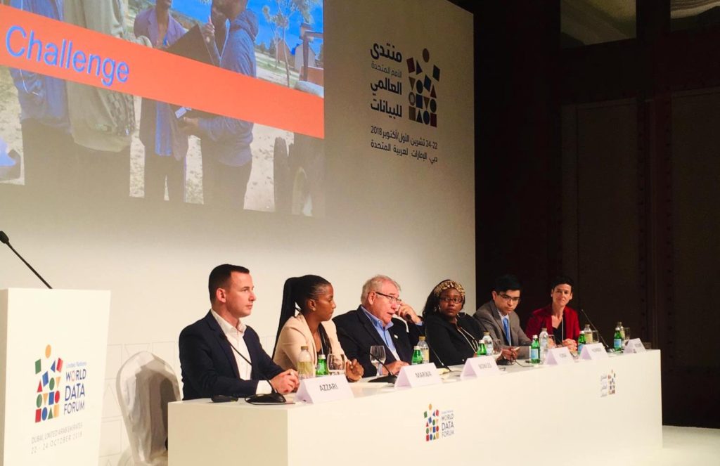 UNWDF Panel Session featuring George Azzari, Ghati Marwa, Juan Bowles, Rose Funja, Michael Humber and Sonja Betschart
Presentations from Dr. Juan Landivar Bowles (Texas A&M AgriLife) on his extensive experiences with Unmanned Aircraft Systems for Agriculture Research and Precision Management as well as Dr. George Azzari (Stanford Earth / Atlas AI) on current solutions and challenges with large-scale, fine-resolution yield predictions from satellite rounded out the “application and experience” focused session which was then led into an open and lively discussion between the panelists and the participants.
We now look forward to more detailed results from UMD and IFPRI on the first outcomes of our joint “Pre-Harvest Loss” project in Tanzania and would like to thank all involved in helping us create a compelling and practice-oriented session at UN World Data Forum 2018.
