
Growing without Losing What Matters
July 2, 2026
Mathias Meier of Aiducation reflects on how adopting WeRobotics’ Glocalization Model transformed how their organisation thinks about sustainability.
December 14th, 2017

UNICEF Malawi was the first UN Country Office to express a strong interest in our Flying Labs when we launched WeRobotics. UNICEF’s main motivation was to build the country’s capacity to quickly assess and respond to major flooding. This explains why we began discussing in early 2016 the possibility of providing national and local stakeholders in Malawi with direct hands-on training on how to rapidly deploy drones to inform their assessments and response efforts. These discussions all came together in 2017 and resulted in the best training we’ve given yet on the rapid deployment of mapping drones for disaster response. UNICEF Malawi’s excellent summary of our recent training is available here.
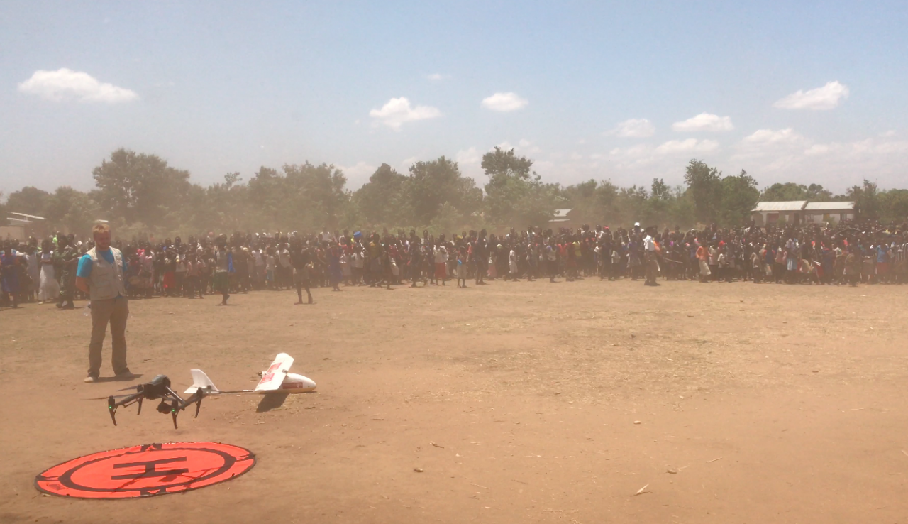
Over the course of three days near Senga Bay, Malawi a select group of national and local stakeholders involved in disaster response training together to discuss how best to integrate drones or Unmanned Aerial Vehicles (UAV) technology safely, ethically and effectively into pre-existing and not-yet existing workflows related to emergency preparedness, response and recovery. Stakeholders attending the three-day workshop and simulation included representatives of the Malawi, Department of Disaster Management Affairs (DoDMA), Malawi Civil Aviation Administration, private drone-related businesses, Malawi Red Cross, World Food Program, and other humanitarian and development non-governmental organizations. Two drone companies, one Malawian and the other South African were also represented. Finally, our Tanzania Flying Labs also participated by supporting the professional training and sharing lessons learned from Tanzania.
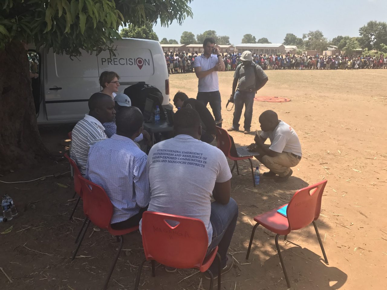
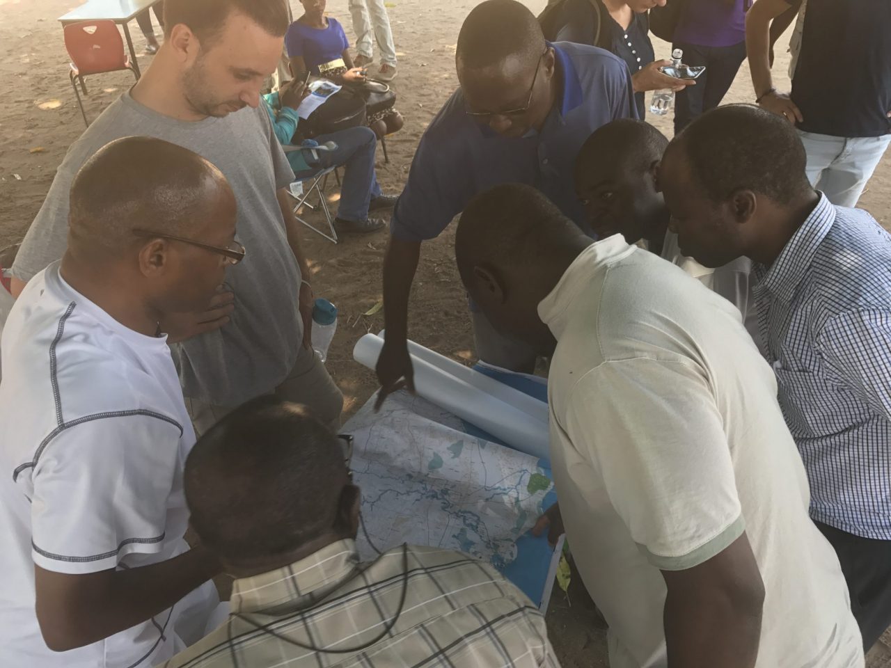
The first two days of training involved presentations with plenary and small group discussion around humanitarian drone global best practices, lessons learned and state of the technology, as well as a gap analysis of issues pertaining to the deployment of drones within an emergency response from the perspective of three assembled teams: drone pilots, data analysts, and response coordinators. The third day focused on a field simulation of drone-assisted disaster response operations. A gap analysis exercise was performed prior to the simulation as a means to capture anticipated challenges in the deployment of drones in a disaster response. It was then reviewed afterwards and used as a tool to discover lessons learned by participants resulting from the simulation. In this way, the gap analysis highlighted anticipated challenges within drone deployment, and then ground-truthed the challenges and proposed solutions with the simulation.
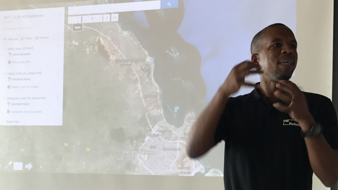
Malawi’s national and local stakeholders were very engaged and dedicated throughout the training. Their level of organization and commitment during the simulation was particularly noticeable compared to other countries where we’ve run similar trainings. The two drone companies were equally stellar and very professional, as was the data team who also went above and beyond. The senior officials from the Civil Aviation Authority (CAA) were phenomenal to work with and far more cognizant of the importance of drones for their country than the vast majority of CAA’s we’ve worked with over the year. In fact, the Malawi CAA was the first CAA that directly asked us to create a Flying Labs in their country. And the UNICEF Malawi team was truly outstanding and excellent partners to collaborate with on this training. I was particularly struck by the fact that UNICEF Malawi already has a long term agreement with the two drone companies -- Precision and Rocketmine -- along with clearly specified information needs such as the spatial resolution of the imagery (standardized at 7cm resolution).
One important lesson (re)learned during the simulation is the need for the first drone flight to be short in order to quickly collect the data and, more importantly, to start analyzing the imagery earlier rather than later. Naturally, multiple drone flights can take place at the same time, but one of them needs to be a short, 10-minute flight maximum since the more pictures are taken, the longer the processing time, the longer the wait for actionable intelligence. What we observed during the simulation in Malawi was what we’ve observed in all our trainings to date: the drones fly for 30+ minutes, and then the imagery processing takes an hour or two. So for a good two hours, the Data Team sits idle, responders remain desperate for information, the media starts to criticize the slow response, and politicians scold the responders. In the case of Malawi, the Data Team improvised by analyzing the raw imagery but this was a tedious task.
Our training in Malawi also underscored another long standing issue we’ve encountered in this space well before we even founded WeRobotics. The rapid analysis of aerial imagery remains a major challenge. Aerial imagery is already a Big Data problem. So analyzing aerial imagery in the field and incorporating the data into standard assessments is doubly challenging as we witnessed again in Malawi. Ultimately, it is inevitable that we will increasingly have to draw on automated or semi-automated methods powered by Artificial Intelligence (AI) and computer vision. But some solutions already exist to accelerate the analysis so it is imperative that more training be focused on enabling our partners to make full use of existing solutions.
I was also intrigued by participants’ focus on the need for cross-border collaboration with Mozambique to facilitate rapid deployments of mapping drones for disaster response. This need has not come up in any trainings, seminars or workshops that I have run since 2014. It was also particularly notable that participants specifically asked for us to give a similar workshop focused on the use of cargo drones. This too had not been requested at previous trainings.
In sum, this partnership with UNICEF Malawi was a very insightful one for all of us and we look forward to working with UNICEF to continue building the country’s expertise in the use of drones for disaster management and more.
WeRobotics co-founders have been providing professional hands-on trainings and giving advanced policy seminars on the use of drones in humanitarian settings well before WeRobotics was founded. Co-founders Patrick Meier and Andrew Schroeder gave policy seminars on best practices and lessons learned to seasoned humanitarian professionals through the Humanitarian UAV Network (UAViators). These unique seminars included best practices and lessons learned on the coordination of drones in humanitarian settings. Patrick and Andrew also spearheaded the development of the International Humanitarian UAV Code of Conduct though UAViators. During this time, co-founders Adam Klaptocz and Sonja Betschart gave technical, hands on trainings and carried out drone deployments in a dozen countries through Drone Adventures. Joel Kaiser, now at WeRobotics, was directly involved in UAViators trainings and Drone Adventures projects in the years leading up to the founding of WeRobotics.
WeRobotics has since expanded these policy seminars and technical trainings through our Flying Labs and consulting projects with multiple humanitarian organizations including UN agencies. In 2017, WeRobotics teamed up with the World Food Program (WFP) to provide very similar trainings combining the best of UAViators and Drone Adventures, i.e., a combination of policy and technical trainings. We were asked by WFP to lead these professional 3-day trainings in the Dominican Republic, Peru, Myanmar and Mozambique. Following these trainings, we also wrote detailed summaries and produced customized national roadmaps geared towards national stakeholders to implement drone coordination mechanisms in their countries. As noted above, we were also invited by UNICEF Malawi to provide similar a similar training to build the country’s capacity. It should be noted that the content we use for all of our trainings is directly sourced from our own deployments, experience and applied research.
Given the growing demand for our demonstrated expertise, we expect to lead more trainings in 2018 focused specifically on empowering local government and local non-government organizations. We’ve witnessed first hand that these actors are the key to enabling the safe, rapid and effective deployments of drones for disaster risk management. In other words, we’ll be taking a bottom-up approach by continuing to localize our expertise. This expertise includes best practices and lessons learned, standard operating procedures, codes of conduct, flight planning and operations, coordination mechanisms and communication protocols, imagery processing and analysis, and regulatory requirements, for example. Each of these modules are directly customized to individual countries and stakeholders. So the more funding becomes available, the more we’ll be able to scale these local trainings. To learn more about our upcoming trainings and humanitarian projects, please contact Joel Kaiser at joel@werobotics.org and join our Google Group.
