Disaster
Drones, data and AI for more effective disaster, emergency & humanitarian aid management
- Our Work
- Technology Solutions
- Disaster
Drones and the data they generate significantly enhance the capabilities of disaster response, risk reduction and search and rescue efforts, ultimately contributing to more efficient and effective emergency & humanitarian aid management. Applications include:
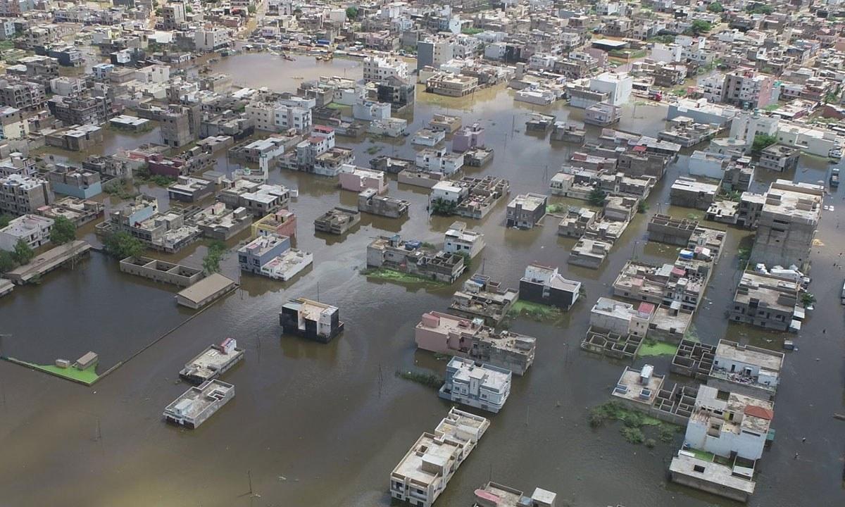
Rapid Damage Assessment: Drones can quickly survey disaster-affected areas, providing high-resolution imagery and data to assess the extent of damage to infrastructure, buildings, and roads. This information helps in prioritizing response efforts.
Mapping and 3D Modeling: Drones capture high-resolution images that can be used to create detailed maps and 3D models of disaster-affected regions. This aids in better understanding the terrain, planning response strategies, and optimizing resource deployment. Such data is also valuable for post-disaster recovery planning, helping authorities and organizations prioritize reconstruction efforts and allocate resources effectively.
Monitoring Hazardous Environments: Drones can access hazardous or inaccessible environments to monitor and assess the situation without risking human lives.
Disaster Risk Management: Drones are used in disaster risk management and reduction by creating baseline maps and conducting risk assessments in vulnerable areas, like for example areas prone to perennial floods, landslides or wildfires. This information helps in developing strategies to mitigate risks and plan for future disasters.
Search and Rescue Operations: Drones aid in locating survivors in disaster-stricken areas. They can cover large and/or inaccessible areas quickly, identify heat signatures, and provide real-time information to rescue teams.
Collaboration and Coordination: Drones facilitate collaboration among different response teams by providing a shared view of the disaster area. This enhances coordination and ensures that resources are allocated efficiently.

Discover a selection of locally-led applications:
- Drones in Disaster Management in South Africa: link
- Drone Based Rapid Assessment of Melamchi Flood in Nepal: link
- Drone Based Aerial Mapping of Landslide in Nepal: link
- Drones & Disaster Management Training for Government officials in Bhutan: link
- Drones in Humanitarian Action Training in Namibia: link
- Leveraging Drone Technology for Heritage Preservation and Infrastructure Resilience in earthquake prone areas in the Philippines: link
- Flood response in South Africa: link
- Webinar on Drone Applications for Disaster Management: link
This is a limited selection of the many trainings, projects and events led by local experts of the Flying Labs Network and supported by WeRobotics. Contact us for more examples and additional information.
